Ryan Weatherbee
Research Associate
Click
here to see my resume
Hi - thanks for checking out my corner of
our website. I am Dr. Thomas' Research Associate here
at the Satellite Oceanography Lab. I was originally hired to manage
the GIS component of a collaborative project collecting various
oceanographic data in Penobscot Bay, Maine. However, over time, I
have branched out and am now responsible for collection, management and analysis
of a variety of remote sensing and other data products used in our research. These
products include time series of satellite imagery (SeaWiFS and MODIS chlorophyll,
and AVHRR Sea-Surface Temperature), buoy data, NAO Indices and anything
else that is required for research we are conducting (lobster densities
for instance).
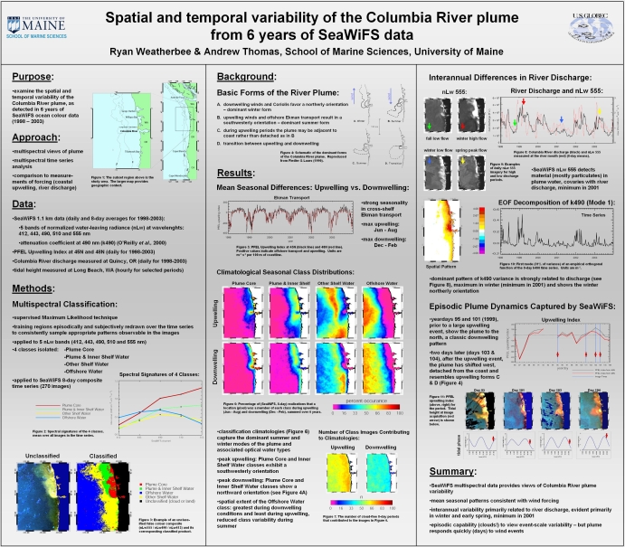
The following poster (presented at the Eastern Pacific Oceanography
Conference (EPOC)) is an example of the sort of research I do here at the
Satellite Oceanography Lab.
Click on the image below to load a high-resolution version (~1.3 Mb).